Translate

Sunday, May 22, 2011

Good Barn, Bad Barn, . . .

As a barn enthusiast (if there is such a thing), I am always on the lookout for interesting barns.  As I travel around, I take photos of barns of interest.

Good Barn


This is the round barn at the Shelburne Museum.  It was built in 1901 in East Passumpsic, Vermont.  It was relocated to the grounds of the Shelburne Museum in 1985/1986.

Okay Barn


This little barn is used for hay storage in Vergennes, Vermont.  I always liked the saddle-shaped slate roof.  It is well maintained, but the sagging roof and separated siding indicate some structural damage.

Sad Barns


This barn has lost one side and part of the roof.  In time it will collapse as water gets in and the structure gets weak.


This a another round barn, but the roof is gone and it is soon for collapse.  It takes a lot of money and time to keep a barn in good shape.

Recycled Barn


I've been watching this barn get disassembled.  My guess is that the wood is being sold to a company which reuses the wood for furniture, new construction, and flooring.  It's better to see the structure get recycled than rot away.

Saturday, May 14, 2011

Springtime Yellow and White

It was going to rain later in the day, so I jumped on the bike early in the morning for a short 20 mile ride.  I went along one of my favorite roads - some good hills, marshes, woods, meadows, pastures, red-barned farms, old houses, creeks, covered bridges, and little traffic.

Along the way I noticed that the dominant colors of the wildflowers were white and yellow.


A dense cluster of Trilliums and Sedums.


Dandelions


Marsh Marigolds


Winter Cress

As the summer comes, more colors will appear.  I'll keep an eye out for the change of flower colors.  Enjoy!

Tuesday, May 10, 2011

The Flooding Continues

We have had several rain-free days.  Blues skies, moderate winds from the north, and high temperatures around 62 degF.


Lake Champlain is slowly receding.  After reaching a peak over 103 feet, it is around 102.5 feet today.  It will take many weeks before it is under flood stage.

Though we don't live on the lake, I am continuously confronted by the flooding.  There isn't a day when I go cycling that some road isn't closed, or a bridge has water over it.  Hundreds of homes and camps are flooded.  Our flooding is not as extensive as that of the Mississippi, but we still have a lot of damaged roads and ruined homes.

The Otter is starting to drop in level and volume.  I noticed it was more blue than brown today, though the major tributaries (like the Lemon Fair) are still brown and muddy.


Joining of the Lemon Fair with Otter Creek

There has been a lot of flooding of farm fields.  The runoff is introducing large amounts of phosphorus into the lake.  I wonder what the streams, slangs and lake will be like in the coming weeks and months.

Sunday, May 8, 2011

Trilliums and Earthballs

I went for a long bike ride yesterday.  In my younger days, I would just ride as hard as I can to train for racing.  As I have gotten older and stopped racing, I find myself looking off to the woods and the streams.

Yesterday I came across tons of trilliums ("... billiums of trilliums ...") growing in the shady roadsides under the trees.  Trilliums are some of my favorites.  I jumped off my bike and took a few photos.


Just down the road I saw a strange sight.  I got off my bike to investigate.  Looks like I came across some earthball mushrooms (genus Scleroderma).  They are poisonous, unlike the larger puffball mushrooms which I blogged about before.


Always  take the time to look around.  You ever know what you will find.


Happy Mother's Day!

Monday, May 2, 2011

From the Lake to the Mountains

Yesterday was a perfect day.  The winds were calm, it was sunny, the temperatures where in the low 70s degF. Spring is in full bloom.  The grass is green and growing like crazy.  The trees are leafing out, and the wildflowers are starting to bloom.

I started the day with a bike ride down by the lake.  I was planning on riding to Rt 125 and crossing the little causeway by the lake.  However, the recent flooding had the road closed.


As I headed home I looked at the construction of the Crown Point Bridge.  It is one of the few bridges that cross Lake Champlain.  This bridge was demolished recently and is to open later this year (we hope).


When I got home, the wife an I went for a short hike into the Green Mountains.  We drove south and turned east onto Rt 125.  Rt 125 comes up from the lake, through dairy farms, and into the Green Mountains.  We stopped at the Robert Frost Trail (which I visited a few times in the winter).


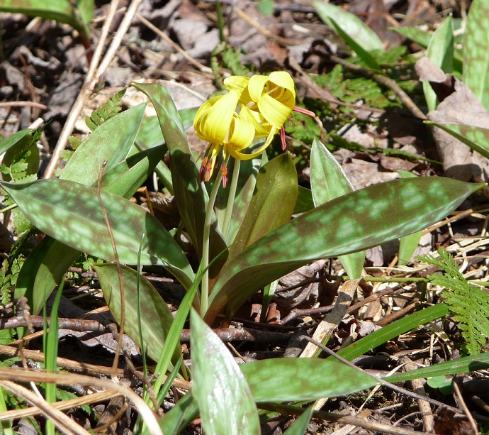
We made sure to look down and take in the wildflowers.  We saw Nodding Trilliums (which I have never seen before), . . .


. . . tons of Trout Lillies, . . .


. . . wild Phlox, . . .


. . . and Fiddleheads.


We then drove over the Green Mountains, and descended the mountains for a few miles.  We came to one of our favorite areas, Texas Falls Recreation Area of the Green Mountain National Forest.  There are trails by the falls, as well as a beautiful picnic area.


 Rt 125 is one of the great drives through Vermont.  Enjoy.

Saturday, April 30, 2011

After the Flood

It was a beautiful day.  Comfortable temperatures, clear, azure skies, and no rain.  I first went for a bike ride, and then went for a paddle on the Otter.  With the lake at a record level, I thought it would be interesting to see what the flooding has done to the wildlife.


I decided to paddle at the mouth of the Otter and head upstream.  As you can see, the road was flooded, so I just put-in on the road and headed through the woods until I hit the river.


The flooding is extensive. If you took away the trees that line the bank, the river would look like it is at least 8 times wider.


The lake is 2 feet over flood stage.  The flooding makes the river look like a swamp.


There is a lot of debris in the river.  In one section where the river turns due north, the south-blowing winds were pushing the north-flowing debris.  The water was full of log, sticks, and plant matter.


Some animals seemed to take the flooding in stride.  The geese were about as usual...


... as were other waterfowl.


I saw a beaver lodge.  With the high water, the lodge was probably flooded.  I wondered if there were beaver around...


... and there were.  The adult beaver saw me, went into the water, and slapped its tail, moving away from the lodge while continuing to slap the water to draw me away.  I know this trick, but decided to move on anyway.


I paddled into a hidden marshy area.  I saw that the muskrat dens were flooded.  The muskrats were probably around.


Not only has the flooding displaced the beaver and muskrat, but some of the wood duck boxes were flooded.  The flooding has hit some people hard, as it has the wildlife.


The redwind blackbirds seemed oblivious to the flooding


I paddled upstream to the mouth of Dead Creek.  At this point a road comes close to the river.  I went cycling by here a few days ago.  The water is even higher.  I was able to paddle over the road to Dead Creek, and then back to the Otter.


I saw my first sandpiper.


Osprey were everywhere.  I saw at least 7 nests.  All of them had a pair of osprey in them.  Some were solitary..


 ... some were working with their mates ...


... and some were keeping an eye on me.


I also saw downy woodpeckers.


I paddled away from the river into one of the flooded areas.  I saw muskrat eating and sunning themselves.


One thing I wasn't expecting to see..., the first turtles of the season!


The flood had an immediate impact on the river.  It will be interesting to see what nature does in the next few months.

Friday, April 29, 2011

Across The Lake

In a previous post, I mentioned that I was looking forward to paddling across Lake Champlain from the Vermont side to the New York side.  Near us, the New York side of the lake rises hundreds of feet.  The cliffs are home to falcons, and after a lot of rain, covered in waterfalls.  The lake has little boating on it this time of year.  It  is a great time to explore the cliffs and take in the wildlife.


Though we have had a lot of storms and rain the last few weeks, the winds were light today.  The lake is at record heights (102.5 feet around noon today).  By late summer, it will be 6 or 7 feet lower!

The skies were unsettled.  I ran into a few sprinkles driving to my put-in place.  I unloaded my kayak, checked I had my spare paddle, paddle float, bilge pump, camera and other gear.  I was off.

I encountered a few 1 foot waves by the mouth of Kingsland Bay, but the wind died down by the time I reached the New York shore.  It was about a 2 mile crossing at this part of the lake.


I stopped paddling and heard the sound of rushing water.  There were numerous small streams pouring down the steep walls.  I paddled south along the cliffs.  In the distance were waterfowl.  Ducks, geese and heron were about.


I saw a heron fly off to the west.  I then saw more herons flying about.  I wonder if there is a rookery nearby...


There would be a small waterfall every 100 to 200 meters.  I love watching the water.


You have to paddle right into the falls.  By summer, they will be gone.


I continued paddling south.  I was nice being on open water.  I like to paddle the local rivers, marshes and slangs, but there is something about being on big water that is appealing.  Maybe it is the ability to have unobstructed views, or being able to just focus on paddling towards a far-off place.  Its very relaxing, just picking a point far away and traveling to it.


Overhead I could hear a falcon cry out.  This part of the lake is home to peregrine falcons.  They nest in the cliffs.


I looked up one part of the cliff face.  I saw vultures soaring overhead.  No, I don't think they were watching me!


I could hear loons calling.  I started paddling back to the Vermont side and ran into several loons.  Their call is haunting.


I was heading towards the Diamond Islands.  They aren't very large.  Just a few large rocks, some gravel and a small lighthouse in the middle of this part of the lake.  I was surprised how high the lake is.  By mid-summer, the 2 islands will become one.  You can see how high the lake is by the submerged trees.


As I paddled back, I could see Camel's Hump off in the background.  Beautiful!  It wasn't a long paddle, but it was full of great experiences.


Peace.